TurningDieselIntoMemories
My travels into the outback of Australia
The West MacDonnell Ranges
Blog #16 – West McDonnell Ranges – Days 88 to 94 of 180

After a hearty breakfast and a reasonably good coffee it was time to depart from Kulgera Roadhouse heading towards the West MacDonnell Ranges but not before airing up our tyres as we would be on tar for the next few hundred kilometres. I thought I had lost my HEMA Red Centre map at the roadhouse so was keen to find a replacement at the next large roadhouse at Erldunda 74 Klms away. Sad to say they didn’t have what I wanted but they did have something for an early lunch for us and as the place was a madhouse full of grey nomads heading north, I just wanted to leave and go anywhere else but with them. by the way the map had dropped into the footwell of the car as I had turned to go for a drink – you wally David!!!!
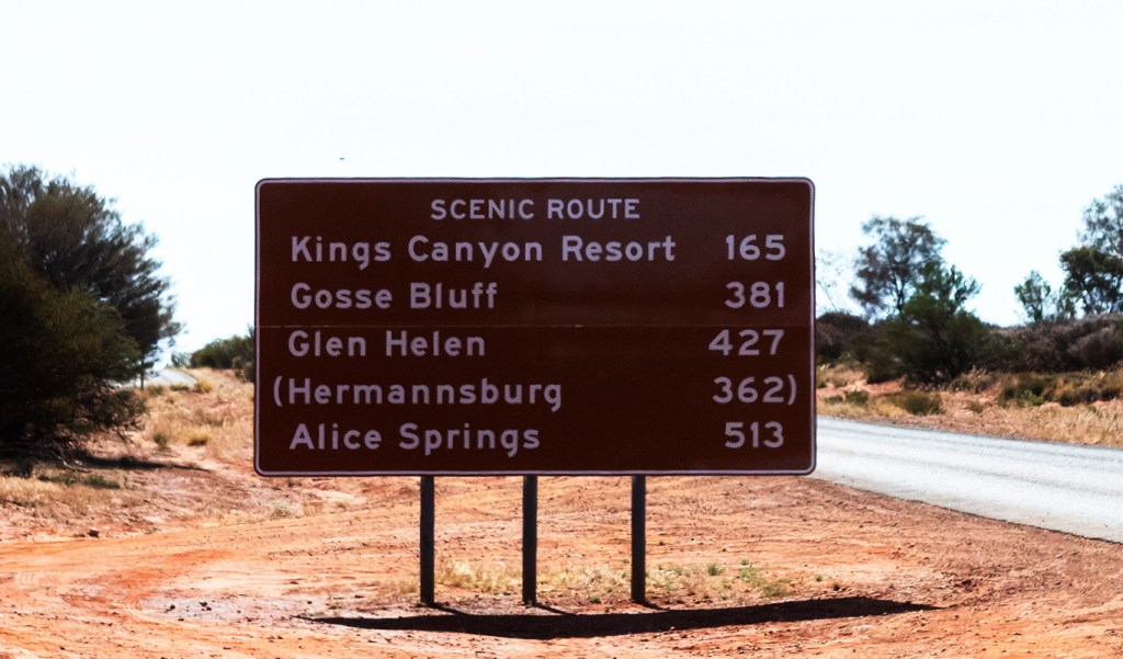
Turning east along the Lasseter Highway from Erldunda we had 106 klm to go before turning West then North towards Kings Canyon along the Luritja Road. We had planned on free camping at a wayside stop some 50 klm from the turnoff but were not very impressed with that site so decided to push on. I had read that Kings Creek Station was a better, and cheaper place, to stay than at Kings Canyon Resort a another 30 klms up the road so headed there.
Arriving late in the afternoon we booked in for two days but immediately ran into a problem with the sites allocated to us still in use by someone else on one and too small to fit my trailer on another. Back up to the office where they were most apologetic and allocated me another site which was slightly bigger but really meant for small camper vans. I managed to squeeze into the site before unhitching the car as I was blocking the roadway whilst Greg setup some 50 metres away in a small cul-de-sac on the edge of the campsites.
I soon setup the awning and put up two walls to block the wind which was very chilly. Next was to setup my bedroom on the second floor which did not take long. Next was a trip to the ablutions block for a much-needed hot shower after a long day.
We decided that we would eat out for the two nights for our stay and because the wind was strong and cold early nights were in order as a fire would be a waste. The food was quite good and the young lady who served us said buying six packs of beer was cheaper by far than individual drinks, $32 ($5.33 a stubby) for a 6-pack vs $45 ($7.50 a stubby) individually, how could we refuse! As the kitchen closed at 7pm we headed back to our beds as the wind was getting colder. I had three young backpackers camped next to me huddled around a small fire and very rugged up. My 5 blanket doona was going to be a lot warmer so I was tucked up in bed by 7.30pm and left them to it. Of an evening I have plenty of movies and tv series to watch as I had them stored on a hard drive. If I did not want to watch a show, I had a few hundred eBooks to read or I could type some notes for the blog so I wasn’t short of evening entertainment on this trip.
About 9pm I could hear about 5 dingoes start howling and they were very close. Like many places in the outback the dingoes come into the campsites to scavenge for food scraps and you are advised not to leave anything out. This went on for nearly an hour but I was not game enough to go out and find how close they were. Next morning, I was up around 7.30 am making a cup of tea when Greg showed up to tell me that the dingoes were right outside his door doing the howling last night. He certainly was not going outside to tell them to bugger off!!
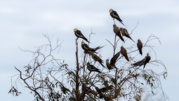
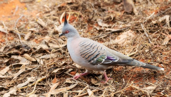
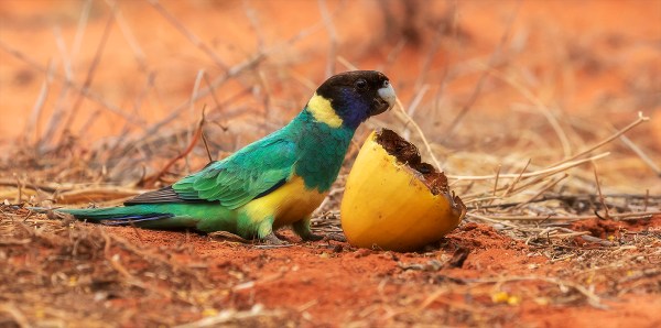
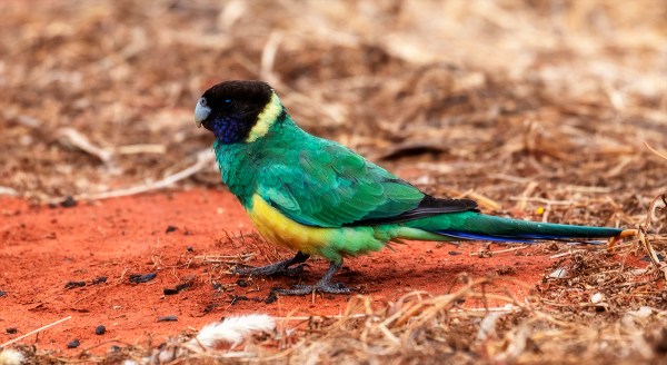
I was disappointed that I could not get a helicopter flight out over Kings Canyon as the company that runs the flights were short of pilots. The other offerings of a camel ride or a 4WD buggy tour of the station did not really interest me so I decided to do some bird photography in the grounds. There were plenty of wild cockatiels wheeling around all day but never quite close enough, Noisy Miners by the dozen, Crested Pigeons & Ring-necked Parrots. I finally found something that will eat Paddy Melons – the Ring-necked Parrot. As the melons were in plentiful supply and the birds seemed unafraid of humans, I cut up two melons and placed them on the berm about two metres behind my trailer. Within 5 minutes I had three birds feeding on the melon sections so managed to get some good shots. I should have cheated and smashed them on the ground to give them a jagged rather than a cut edge – oops sharing birders secrets now. Eventually I managed to get some half decent cockatiel shots as well but no sharp flight shots.

Our next part of the trip around the Mereenie Loop required permits which we would need to purchase at the Kings Canyon Resort as the Kings Creek station had run out of them. No real impost as it was on the way to our destination.
Next morning, we packed up early and had a less than memorable hot breakfast served from a bain-marie but it was filling. On the road again for a short trip up to Kings Canyon Resort to get our Mereenie Loop Passes. We were asked if we had 4WD vehicles as this road is not recommended for 2WD but having driven it I know it can be done if you travel slowly as it is very corrugated.
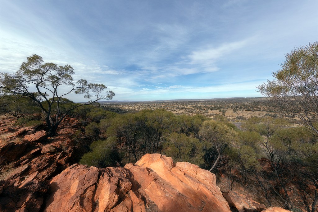
First stop was only 10 klms further on at Ginty’s Lookout. This section of road to drive up here was quite steep and has been tarred. Locally it is known as ‘the Jump Up’, as the road from Watarrka (Kings Canyon) ‘jumps up’ very quickly. At the top of the hill on the right is the lookout which is also a 24-hour campsite with spectacular views towards Kings Canyon. We stopped and checked it out for future reference if we ever came back this way.
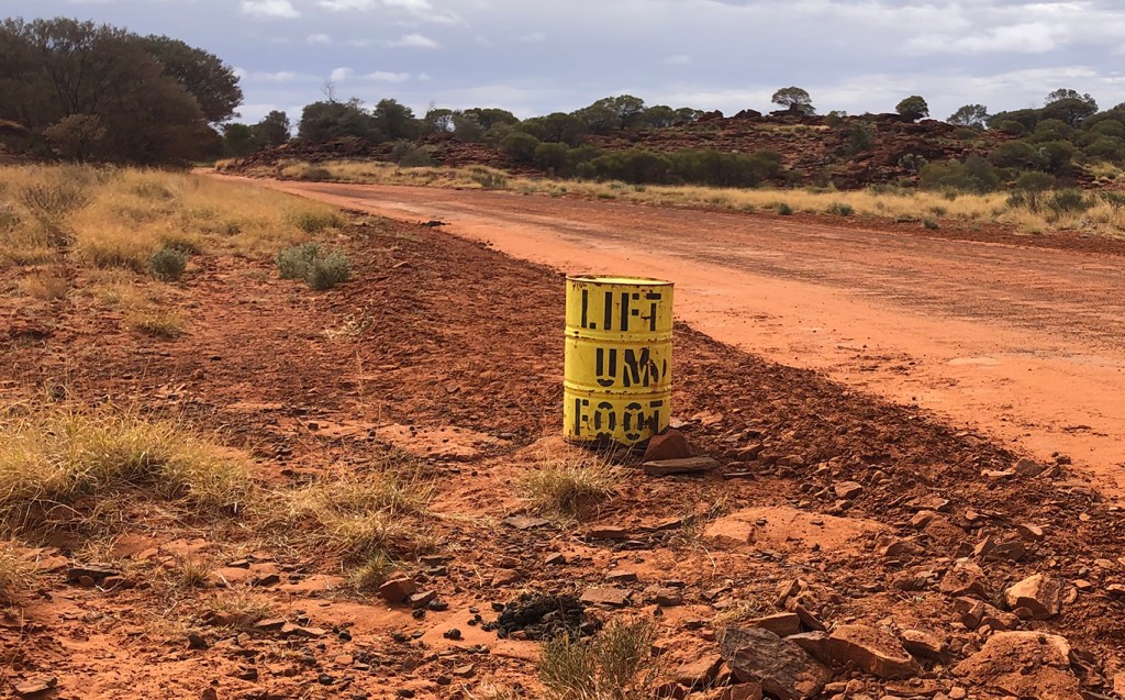
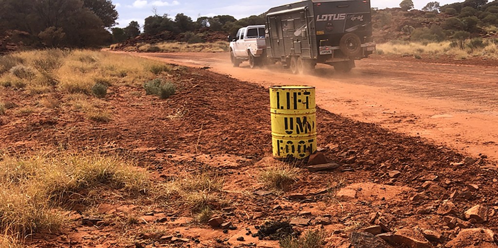
We continued on and I was looking for the famous ‘Lift Um Foot’ drum on a sharp bend. At first, I thought it had been removed as there were new road signs in multiple languages about driving to the conditions and making sure you had your seat belt done up. There were also signs saying only drive on the left as well. I wonder what our foreign visitors make of such outback humour sighting this drum. Apparently, painted on the other side of the drums was ‘Puttim Back Down’ but this has been removed in the current incarnations as speeding on these roads is not recommended.
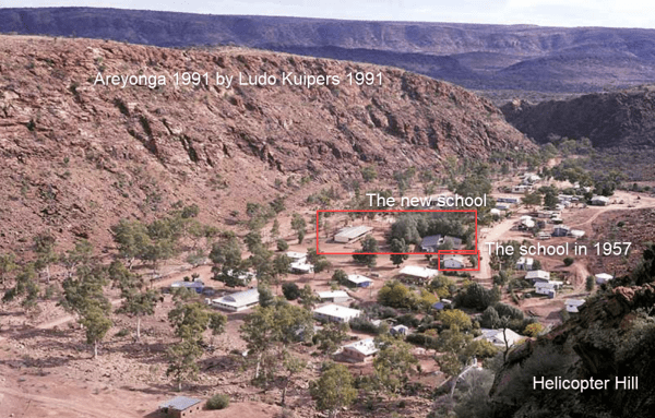
Many people don’t know but my parents were school teachers and had been posted to Areyonga back in 1957 – 1958. It is hard to imagine the difficulties in getting to this very remote community back then when all the roads through here were dirt or sandy tracks. These days I carry all sorts of recovery gear including four MaxxTracks to cope with any offroad experiences. My father used to use tin sheets tied on the roof to aid in getting through the sandy sections in his ’56 Holden, he also had to report in on the radio schedule to tell Hermannsburg Mission that he was leaving/arriving safely to his destination. So, I had my 3rd & 4th birthdays in this small aboriginal community. Mum had asked that if I ever came back this way could I make a trip into the community and take some photos for her. The previous day I had rung the MacDonnell Ranges Land Council seeking permission to visit this closed community and was told that would be OK but I couldn’t stay the night there. That was OK with me but when we got to the turnoff the road was partially blocked saying Road Closed – Locals Only.
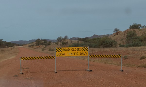
As I had once been a local, I decided to drive around the sign and go in whilst Greg waited on the side of the road for my return. Please note that some of these images contain photos of some aborigine people who may no longer be alive. I apologise for this knowing some of their customs but most Australians who have never been out to the outback need to see what it was like back then. The photos were taken by my sadly departed father Allan Woolcock who died far too young at 47. All the photos were from his slide collection. Any photographic faults I will put down to using the old slide film used in those days and the fact that most people did not realise that slides had to be treated carefully – the heat and humidity of his future postings to Papua New Guinea did not help their condition.

The school parade ground 
The NT Governor visiting the school 
The school 1957 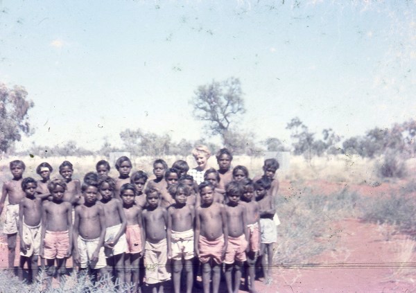
Mum’s boys class 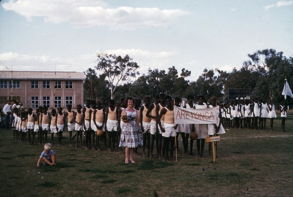
Areyonga kids at an athletics carnival 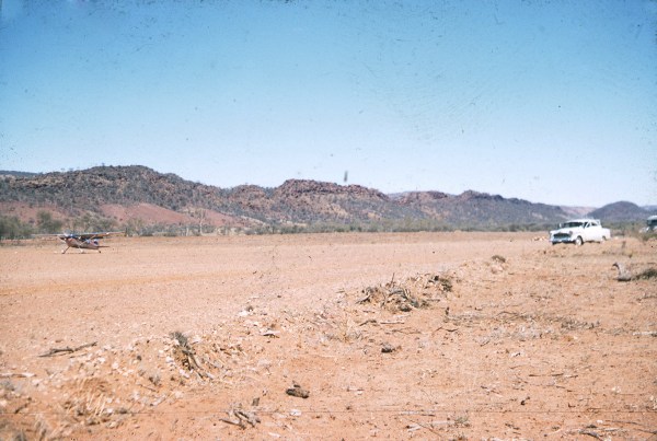
At the airport to pickup the mail 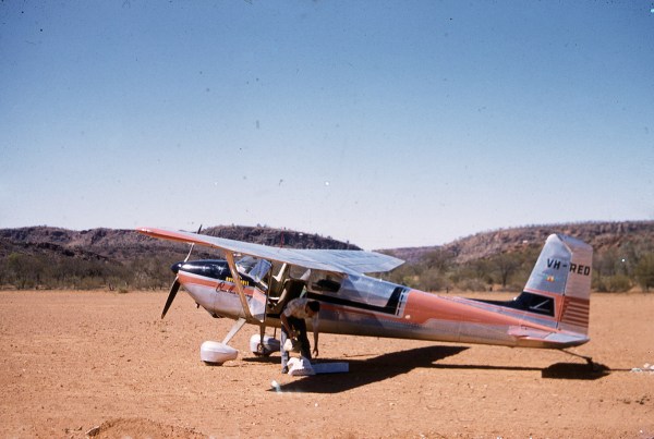
Cessna 180a Skywagon delivering the mail 
On the road again 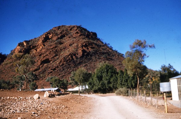
Helicopter Hill 1957 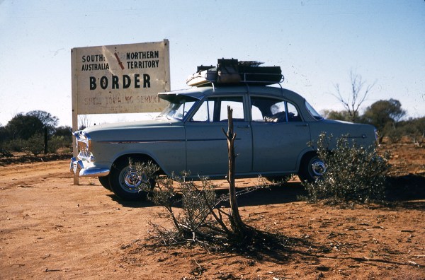
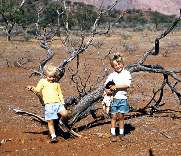
Starting a new life in NT 1957 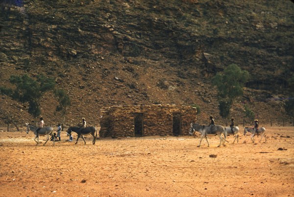
Kids on their pet donkeys 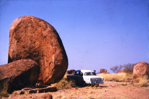
The Devils Marbles 1957
The road into the community was quite good and it was only 19 klm from the turnoff with just a few corrugations. The approach road in is very narrow and twisted with very steep canyon walls crowding the road which ends in hill called Helicopter Hill (don’t ask me why).
The first person I met was rather suspicious as to why I was there but pointed me too a large orange building 100 metres down the road and told me there would be someone there who could help me. This building, I discovered, was the old school building where my parents had taught.
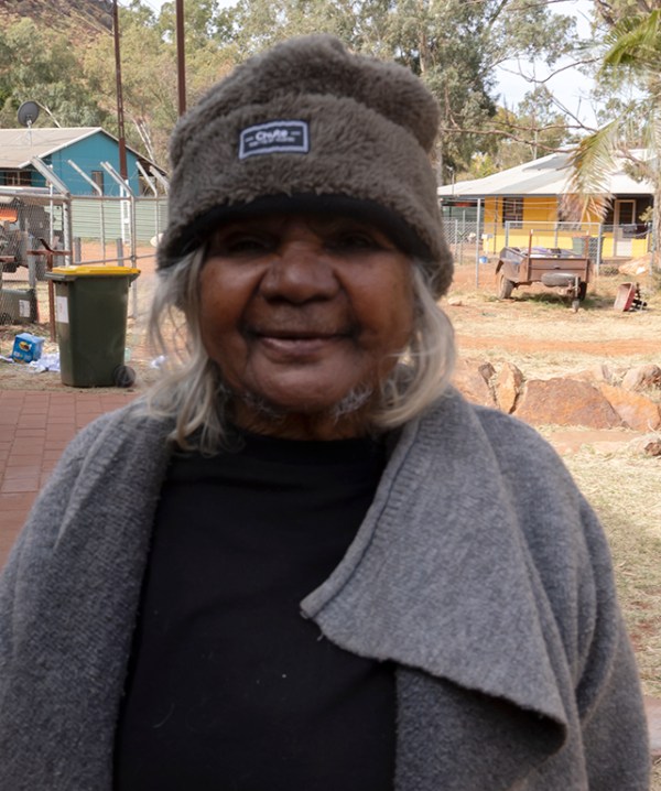
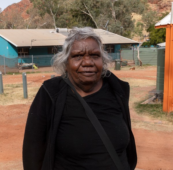
Sadly, my father is no longer with us but I am sure he would be just as excited as Mum was when I said I would be visiting here. An elderly lady came out to see what the fuss was about as I am sure there are not many visitors coming into this small community. When I explained that I had once lived here as a very young boy 64 years ago and my mothers name was Ann she became very agitated and yelled out for her friend to come out. The first person I had spoken to was the elderly lady’s daughter and she explained that her mother and two friends had been at school around that time. Another very elderly lady came out all smiles and said I must take her photo and her friends’ photo to show my mother that they remembered her. I hadn’t told them but they said Mum was a short lady and talked funny (Mum was born in Liverpool in the UK and is only 4’ 8” tall so very short) and they remembered my sister & I but especially me because as a small child I had golden hair. Mum said the people would be constantly touching my hair as they had never seen that colour hair before. Soon we were joined by another elderly lady who was in the same class back then. So now I had met the last of the elderly people who remembered my parents from back then – Emily, Stephanie & Lidja.

Sadly, not many aborigines reach the old age as the Europeans achieve on a regular basis. This was rather an emotional trip into here for me and for Mum especially so close to my birthday. As I could not camp here, I took some photos of the town to share with Mum plus the photos of her old pupils and headed back out to Larapinta Drive. On the way out I ran into another thing that Areyonga is well known for and that is the largest herd of wild donkeys in the region. I saw a half dozen on the side of the road and stopped to take some photos. I was doing my best hee-haw out the windows to get them to prick their ears for the photographs – I am sure they were not impressed but they did oblige.

The road into Areyonga was quite good 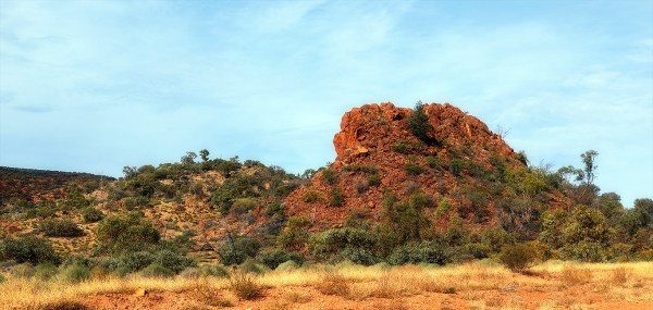
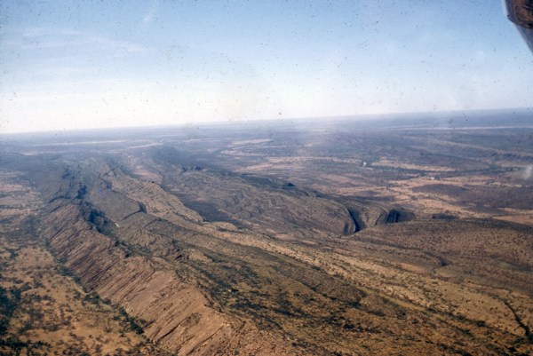
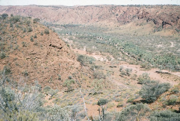
The scenery was spectacular 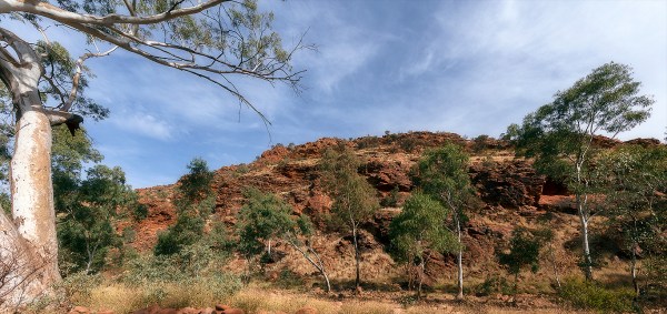
The ridge towers over the community 
The Arts Centre 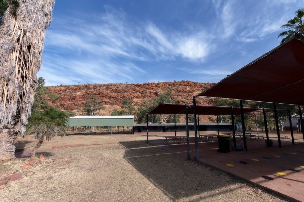
The new school 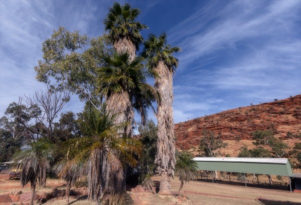
The new school 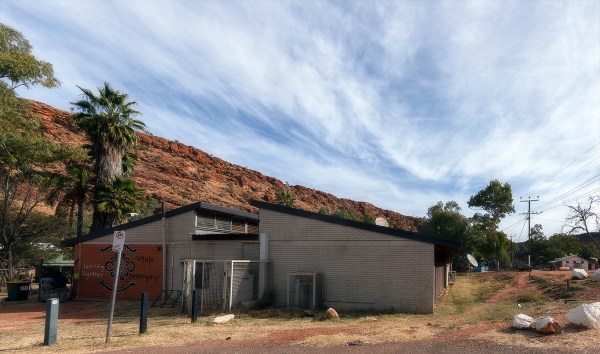
The new school 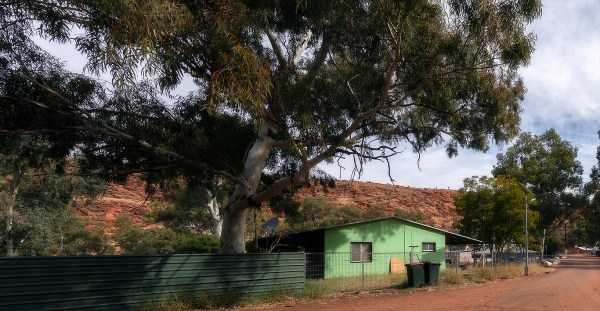

The old school now used as the Women’s Centre 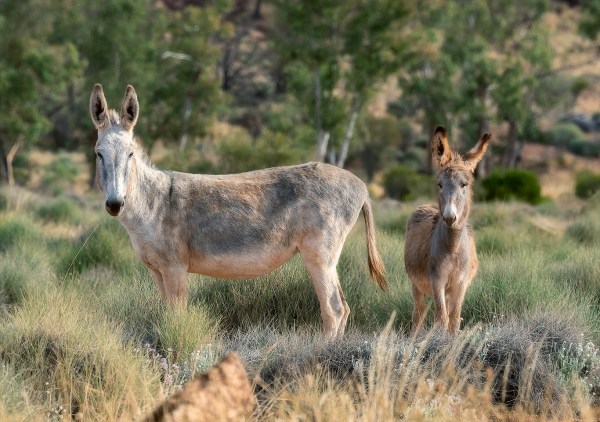
Wild Donkeys 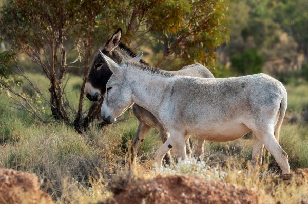
Wild Donkeys 
Wild Donkeys 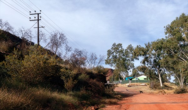
Edge of the comunnity 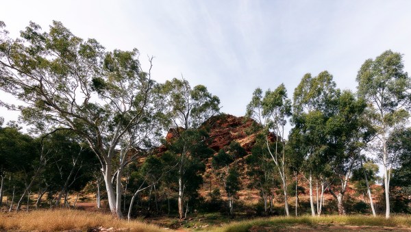
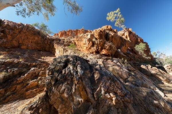
fantastic rock formations in the canyon 
The town sign – it is now called Utju but it will always be Areyonga to me
Back on Larapinta Drive it was time to find a campsite for the night. The road north is called Namitjira Road. Albert Namitjira was a well-known aboriginal artist back in the 50’s and I had always admired his landscape paintings of the West MacDonnell Ranges. At the intersection to turn north towards Mt Sonder I saw the signs for Tnorala (Gosse’s Bluff) and the road going forward was now all tar. From the side of the road this massive crater site which occurred from a meteor strike some 140 million years ago really stood out from the local countryside. I should have read up a bit more about this place because I was hoping to camp in there for a night but found out from signage once we drove in that it was a sacred site and no camping was allowed. I then noticed more damage to my vehicle as I walked back from the information bay – the front left bash plate was hanging on by one bolt plus the Anderson plug that controlled the electric brakes from the trailer had been ripped off somewhere between Areyonga and here and would need fixing. These roads out here are very tough on vehicles and trailers so you need to be prepared. When I checked my maps for the next campsite, we realised we would not make it by dark and would need to camp on the side of the road before it got dark. It was already very late in the afternoon. On the drive out I saw my first susurration/murmuration of budgies although I have read a large group of budgies is called a chatter. I prefer murmuration as the flight of more than a thousand birds wingbeats is like a murmur on the breeze. What an amazing sight as a vast flock of these small birds wheeled around very low to the ground. There was no place to pull off this track so I hurriedly took some shots out the car window. Hopefully one of them will be in focus as holding large cameras and lenses with one hand does tend to miss focus or blur shots. Greg who was in front of me never saw them.
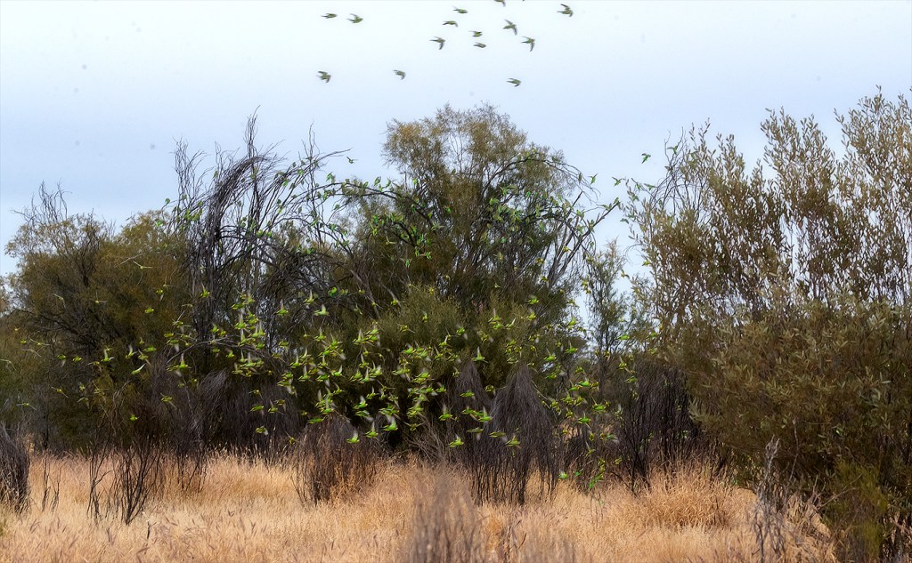
Budgie Murmuration 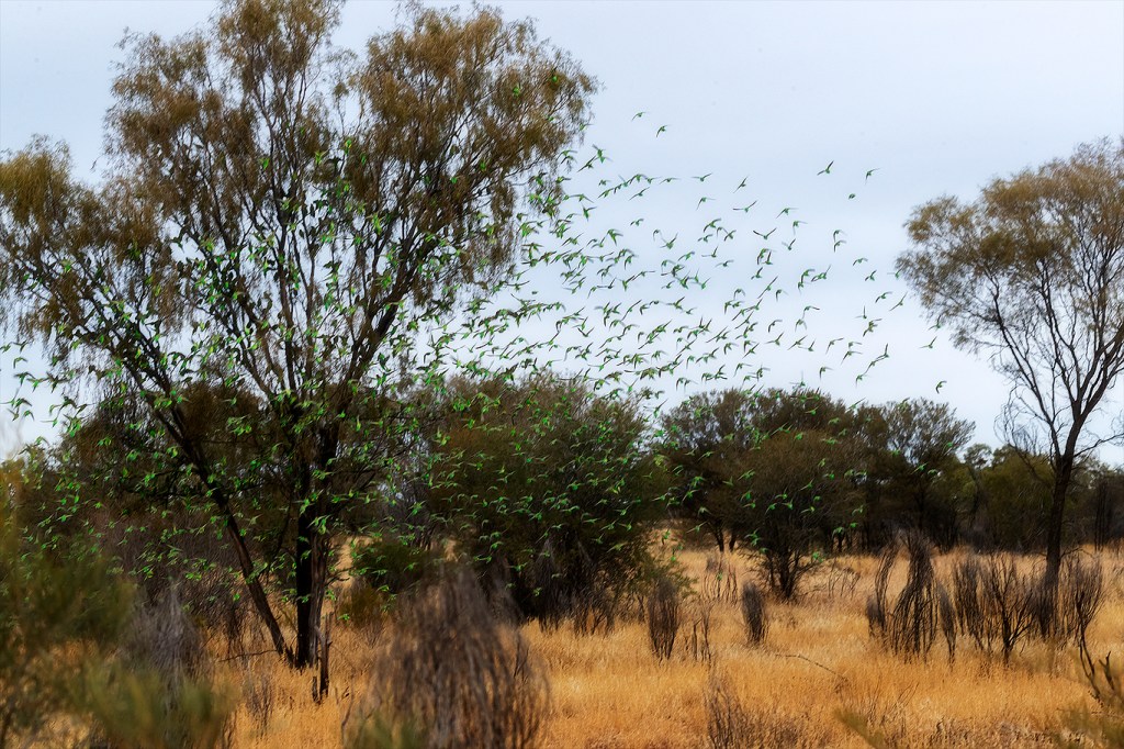
Budgie Murmuration
Back on the road Greg quickly found a flat piece of ground to camp on about 50 metres from the roadway. We had enough time to fix both new issues as we do carry quite a lot of spares and tools to fix these minor issues. Another cold camp of crackers and cheese as it was too cold to sit outside without shelter. The next morning, I awoke to sound of rain drops pattering on my roof and Greg’s admonition to get up, pack up and get off this dirt patch just in case we had a downpour. One of the difficulties of visiting these remote parts of the outback is that you not only have no communications but you cannot get up to date weather reports. And to top that off it was my birthday!!! At this stage of our journey, we were four days ahead of my schedule and my birthday would turn into a search for better shelter.
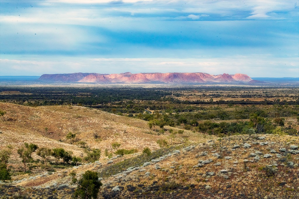
Luckily for us the rain did not last long as I headed up the road to Tyler’s Pass Lookout which promised a fine view over Tnorala (Gosse Bluff). By the way if you ever want to drive The Red Centre Way, I highly recommend buying The Red Centre Way: A Complete Guide for your iPad as it is a great resource (especially if you read it in advance – not like me just when I want to find places!!!) – a free plug for Gary Weir & Amanda Markham and their website Travel Outback Australia.com. The lookout lived up to its name and we took this opportunity to air up before continuing on. From my guide I had found a perfect camping spot on the Finke River called Two Mile Camp just near the closed Glen Helen Gorge Resort. This was only another 130 klm from the lookout so away we went. These ranges are truly spectacular with deep reds and ochre plus having the two highest peaks in the Northern Territory – Mt Sonder & Mt Giles.
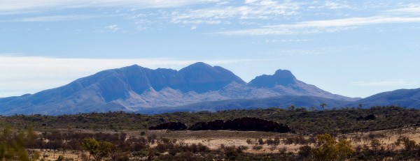
We stopped a few times to grab some snapshots of the scenery before arriving at the Mt Sonder Lookout just above the Finke River. This is an extremely good viewpoint of the mountain ranges from Redbank Gorge to Ormiston Gorge plus the added bonus of being able to check campsites below us looking for a new temporary home for the next five days. We found a lovely spot along the Finke River directly below the lookout across the river. We had also noticed a Queensland registered X-Trail parked at the lookout when we there and over the next few days noticed its owner had not returned. I drove up there after three days and took photos of the vehicle and its rego to give to the Police in Alice Springs if it was still there when we drove into town as it was a bit concerning. This is very lonely country out here and many people enjoy hiking through the hills but I would hate to think something had happened to the owner and no-one noticed or did anything. NB: I subsequently reported this to the Alice Springs Police – hopefully the vehicle owner is OK and was just enjoying an extended bush walk and rugged camping.
We celebrated my birthday with our last bottle of red purchased in Coober Pedy some weeks before and a lovely chicken cacciatore. All of that serenaded by the calls of the whistling kites nesting in the tree behind us and musical calls of the butcher birds and budgies. Nature at its best although we could have done with some more sun. To all my friends who will have wished me a happy birthday on Facebook I will respond once I get to Alice Springs next week.
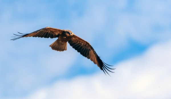
Whistling Kite 
Whistling Kite 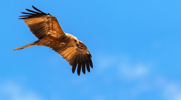
Whistling Kite 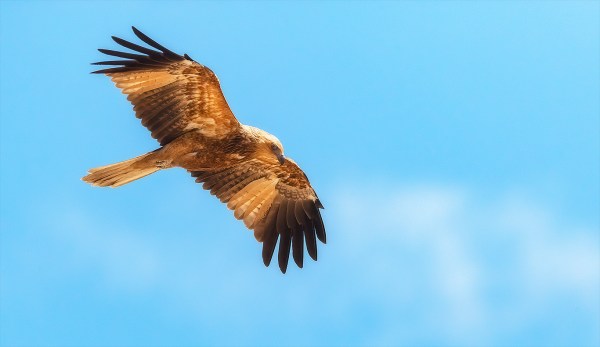
Whistling Kite 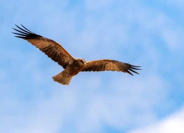
Whistling Kite 
Whistling Kite 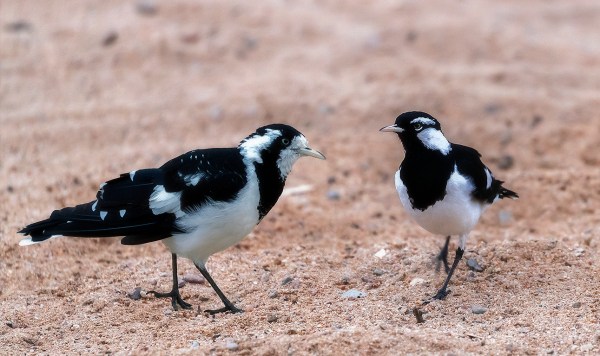
Magpie Larks – Female & Male 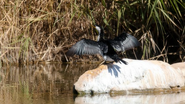
Little Pied Cormorant
The campsite we chose was right in the centre of lots of interesting places for me to go and do some photography as long as the sun was shining. The day after my birthday I walked into Ormiston Gorge (the easy walk not the 2 hour jobs) and into Glen Helen Gorge. Not sure why the latter is no longer open but you can still access the gorge by a foot trail. Most of my images were from the roadway as that was a more photogenic spot.
Ormiston Gorge 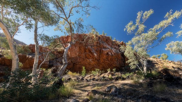
Ormiston Gorge 
Ormiston Gorge 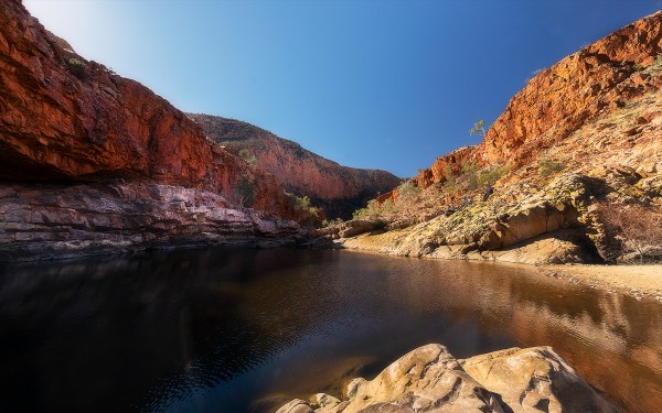
Ormiston Gorge 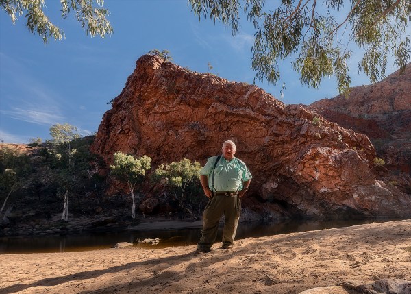
I don’t often do selfies
The next day was a total blowout with gale force winds which started at around 2.30am forcing us out of our beds to hurriedly hammer in more tent pegs so the campsite would not be uprooted and destroyed. If possible, the winds got even stronger around 6.15am and again we were out but this time with 50cm pegs as some of the 30cm pegs had started to lift. Back to bed again as it was too cold to be up and about but could not sleep listening as the wind whistled through the site. I heard others packing up and driving away but opted to stay snuggled up until 11am when the wind abated a bit. There would be no solar today so Greg & I opted to run the generator to get the batteries up to 100% and hope the wind died so we could start packing up for our trip into Alice Springs tomorrow. Photography is a bust today with gray skies, intermittent showers of rain and the landscape looking very drab. Hopefully the sun will shine tomorrow and there will only be light breezes to pack up.
The rain continued all night but the wind finally abated around dawn. Not the best night’s sleep I had ever had but it was pack up day so out of bed. We had packed most things away the previous evening so we finally left our site around 0945 am. There was one more site I wanted to visit some 21 klm away called the Ochre Pits on the way to Alice Springs. As we were leaving the rain started to drizzle and the cloud cover draped over the hills surrounding us. It was a very cold 8 degC when we hit the tar and not pleasant.


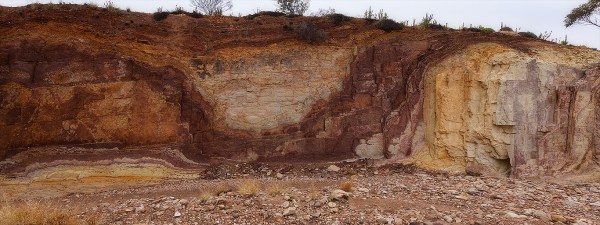
It is only a short walk into the Ochre Pits and the rain had stopped for the moment. There were budgerigars everywhere but mainly young ones. The young budgies had fledged and they were out testing their new freedom by flitting from tree to tree practicing their flying techniques. Greg had stayed up on the road luckily as the parking spaces for caravans was nil – I reversed into a coach space to get my trailer in. I set off with my new favourite landscape lens – Canon’s 11-24mm f/4 – to see the pits for myself. Signage warned against taking any ochre ($5,000 fine) not that I needed it. It was an interesting site with yellow, red & orange stripes through the rock formation. Took my photos and headed back to the car just as the misty rain started again. What a miserable day.
On to Alice Springs and the caravan park we had booked into as our home for the next seven days. Not looking forward to the repair bill for my car but it is to expected when you travel on rough dirt tracks named as major roads in the outback. I would definitely come back to the West MacDonnell as the scenery was magnificent but it would need to have the sun shining on it!
Next time will be about the Alice and the East MacDonnell Ranges. Still living the dream on our epic journey.

Forgot to say..l love the photo of you & Liz..x ________________________________
LikeLike
Amazing nature 🙂
LikeLike
Another great post and adventure. It must have been amazing to return to the place where your parents taught and you lived as a child. How remote it must have been for them. Get your mum to write a book. Photos and scenery is spectacular. We did a three day 4 WD tour around Kings Canyon and Alice Springs and Uluru. We stayed at Kings Canyon Resort with a spa bath in the bathroom with a huge picture window overlooking the red scenery. It was magical and a bit more comfortable than your Adventurous sites. Good on you. By the way don’t knock the grey nomads they are spending money in the outback. Hope the lock down doesn’t cause too much havoc to your adventures.
On Fri, 2 Jul 2021 at 8:40 pm, TurningDieselIntoMemories wrote:
> ozwooly posted: ” Blog #16 – West McDonnell Ranges – Days 88 to 94 of 180 > The West MacDonnell Ranges After a hearty breakfast and a reasonably good > coffee it was time to depart from Kulgera Roadhouse heading towards the > West MacDonnell Ranges but not before airing u” >
LikeLike
Keep them coming Wooly, both entertaining and educational. Love the blogs. Regards
LikeLike
I’m loving your posts! Those Budgies are amazing! What a sight. The fist thing i thought when I saw the photos of the Ochre pits was “oh I’d love collect samples of the different colours” and then read about the massive fines chuckle. I guess that makes sense or they would soon disappear. We’re considering driving to Kings Canyon, Uluru and Alice Springs. But we’d have to stay on the main roads and stay in cabins, not having camping gear with us. I’ll reach out closer to the time to get your advice!
Happy travels!
LikeLike